|
|
| HOME | PROTECTION | NATURE | PLAN YOUR VISIT | FAQ | JOIN/DONATE | ABOUT |
| DOIN' THE DOUG - TRAIL GUIDES |
|
McKenzie River National
Recreation Trail
|
| Length: 26.5 miles 11 trailheads Difficulty: Easy to Moderate Elevation Gain: 1,750 feet 1,450 - 3,200 feet Forest Service Trail #3507 Site: McKenzie River National Recreation Trail |
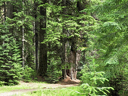
| This trail is occasionally crowded and may bring you face to face
with a mountain biker, but segments of it are can't miss
experiences. To start with, there are wonderful miles of old growth forest, containing Douglas-Fir, cedar, and hemlock of all ages. . |
 |
 |
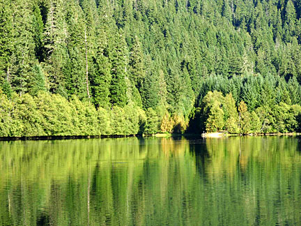
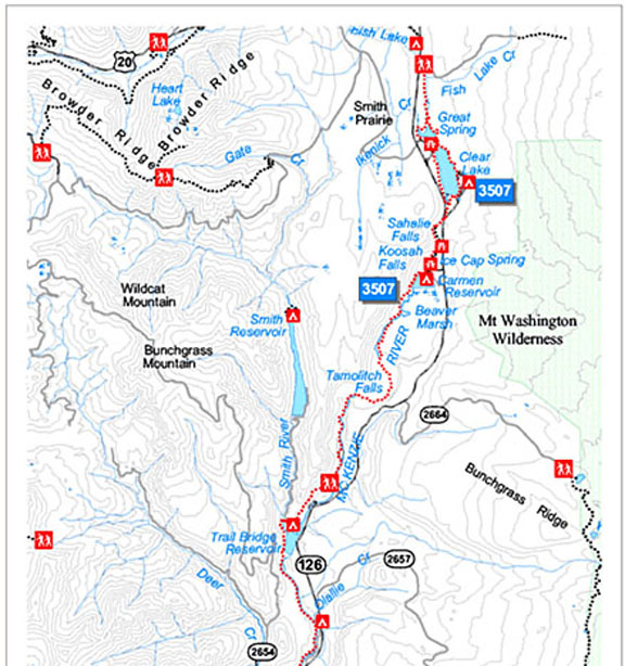
| The star of the trail is the river itself. The trail starts north
of Clear Lake along a small tributary. This flows south into Clear
Lake where the Giant Spring is the official start of the McKenzie
River. Around Clear Lake, the McKenzie River trail is also a part of
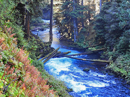
the Clear Lake Loop trail. A key component of the McKenzie River trail is the interaction between the river and recent (less than 10,000 years) lava flows. Clear Lake itself was formed by a lava flow blocking the river. The river overcomes that blockage and flows south. Most of the river is probably flowing through the lava here, but there is a nice small river above the surface for a while. |
 |
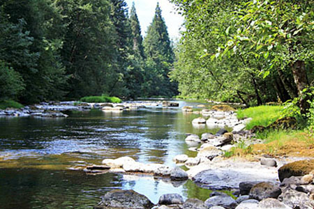 |
| The trail follows the river as it crosses highway 126, and
keeps growing. When the river plunges over
Sahalie and then Koosah (shown here) falls, it provides a
spectacular sight at multiple points along the trail. The trail here also forms a segment of the short Falls loop trail, and can be accessed from the Falls trailhead and parking area. Be careful, though, because the parking area for the Sahalie Falls parking area is often full. Below the falls the trail continues past the Carmen Reservoir and campground (from which you can also hike up to Koosah falls and the falls loop trail). A few miles down river the trail continues but the River just disappears. The trail continues through the forest for three miles where it eventually reaches Tamolich Falls, which, except in spring high flows, is not a waterfall at all. But what the Tamolich Falls marks is the Blue Pool. This pool is full all year as the river flows out of the lava to form a wonderful sight. It serves as one of the major attractants of the whole McKenzie River Trail. |
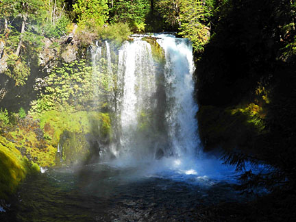 Koosah Falls |
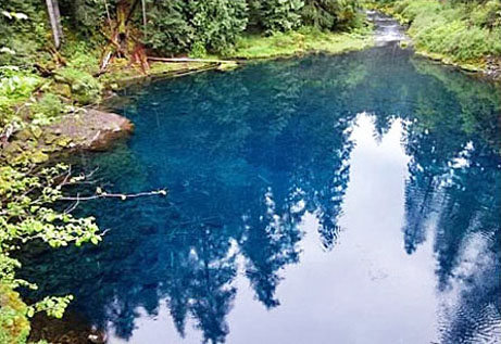 Blue Pool |
| The trail to Tamolitch Blue Pool can be accessed from Carmen Smith
Reservoir (3.3 miles north) or from McKenzie River Trailhead:
Tamolitch Blue Pool (2.1 miles south). The Trail continues down the
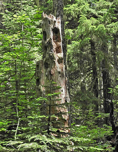
river. The wonder of the McKenzie River National Scenic Trail is that it offers scenes of a beautiful river in all its appearances. It also offers more insights into the importance of the Douglas-Fir. At many places along the trail you can see one iteration of the Douglas-Fir as it provides in-stream insertions that provide shelter for young fish. |
 |
 |
|
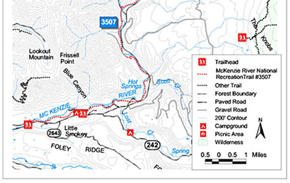
Directions: There are multiple trailheads that access the
McKenzie River trail. The lower end of the trail is just outside
the proposed National Monument. |
 |
 |